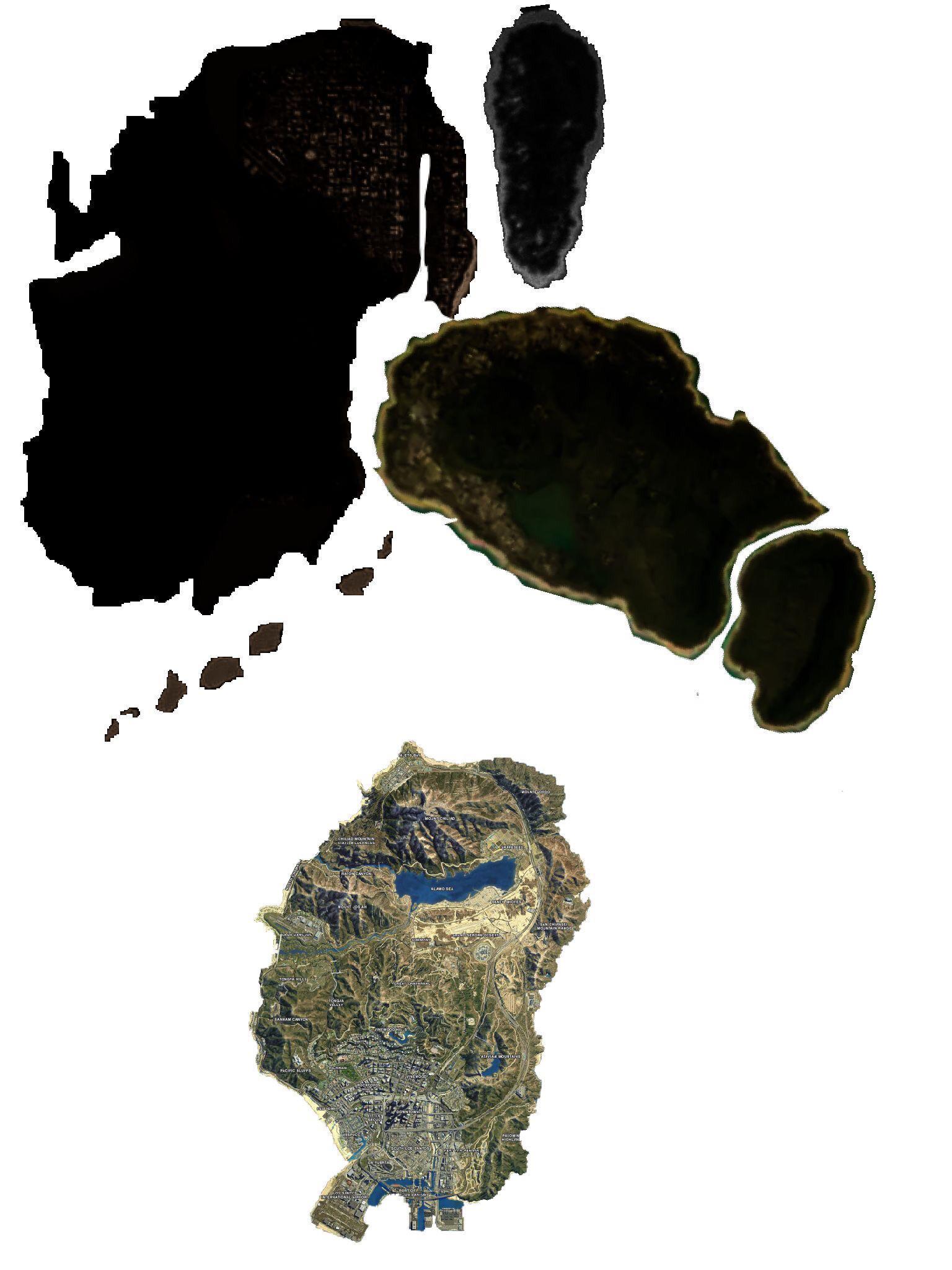
2018 leak

Images in Tweet:
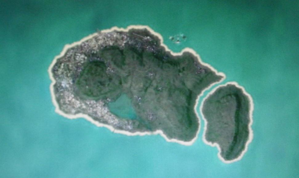
2020 leak
 boards.4channel.org
Image in 4chan post:
Combine the two leaks

Full credit goes to Arthur Bell on GTAforums: https://gtaforums.com/topic/962819-mapping-gta-vi-analysis-thread/
Images in Tweet:
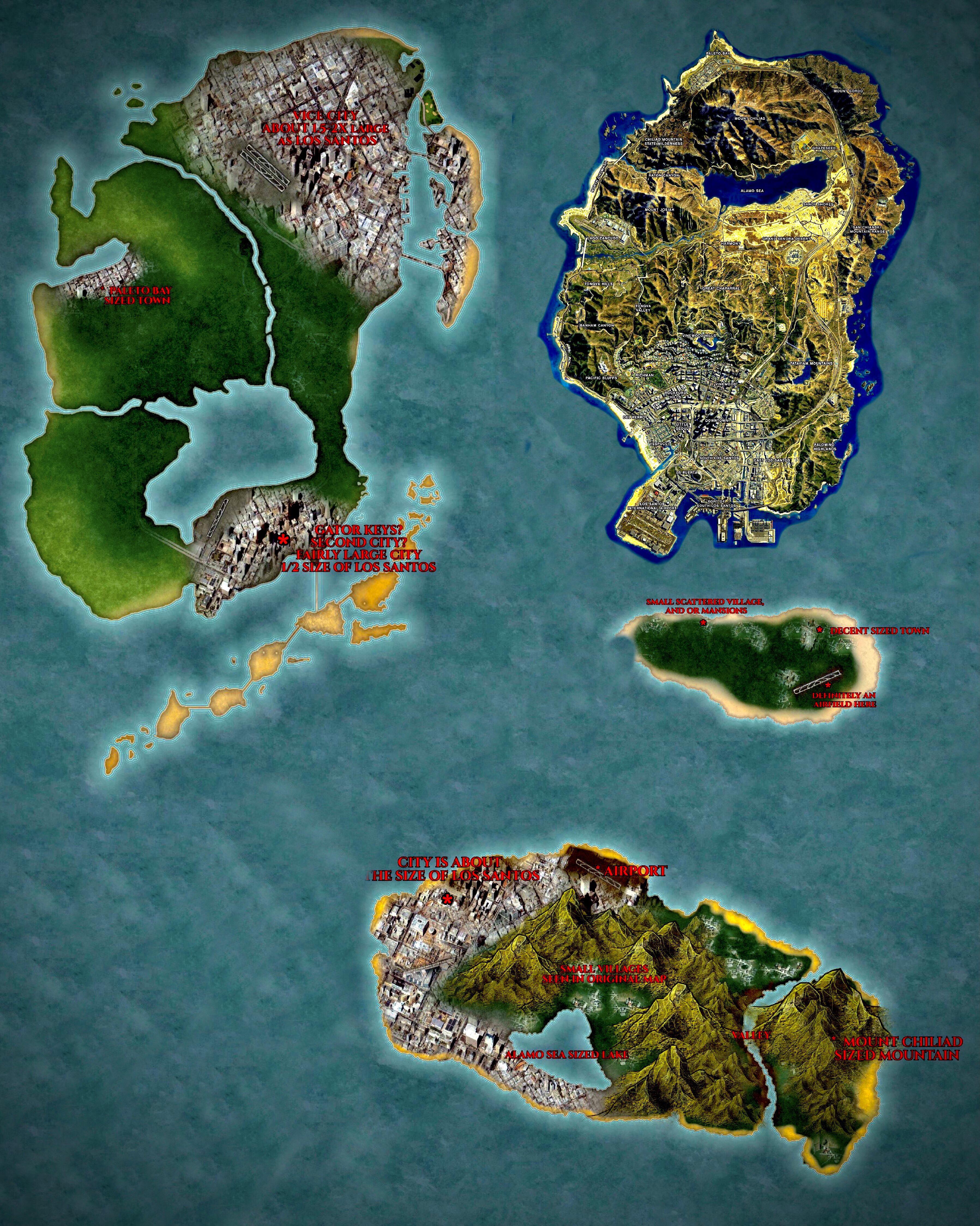
2020 leak
/v/ - an island - Video Games - 4chan
an island - "/v/ - Video Games" is 4chan's imageboard dedicated to the discussion of PC and console video games.
Image in 4chan post:
Combine the two leaks
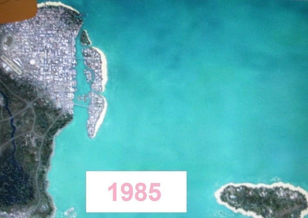
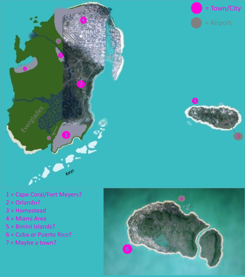
One of the biggest concerns came from whether or not the source of the topography in the leaks is from satellite imagery. I’m going to take a look at an aerial from Miami, and compare it with the “1985” satellite of Vice City.
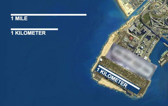
When bringing them side-by-side, there is noticeably a large difference in distance, detail, and scale. For me most noticeably, the airport on the left only shows two runways, and comes in diagonally when looking at it from a north-is-up perspective (great terminology). On top of that, there is a nearby racetrack and casino in both images, likely correlating with the Hialeah Racing and Casino. With that concern, the scaling is rather similar to GTA V’s layout and is not meant to be a perfect replica of Miami. To go an extra step, let’s pretend that the Los Santos Airport is the same distance as Vice City’s. Using the GTA V scale from cptlande the airport is approximately a kilometer long.
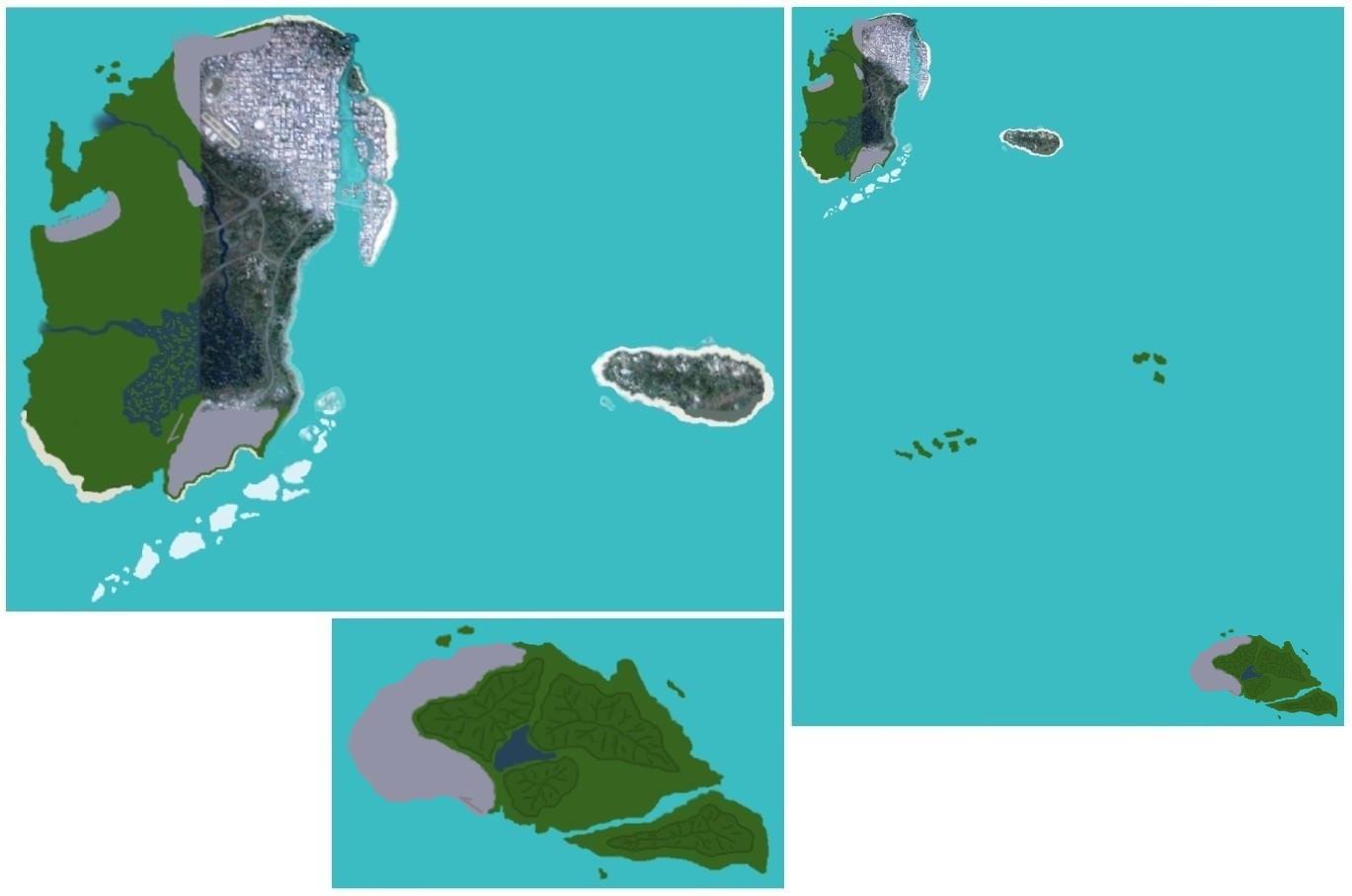
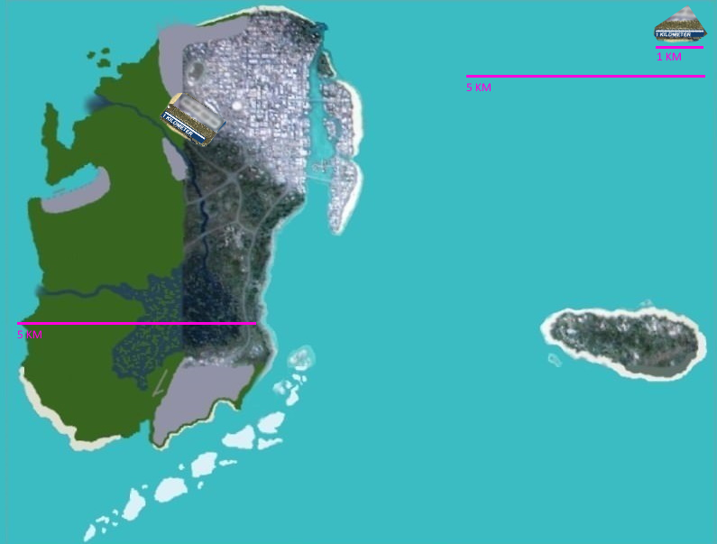
This is not an exact scale, but is intended to come as close to possible with what we have at the moment since we technically only have a few images from this leak. However, the airport is just enough to spur our imaginations. In taking that same scale, I have reapplied it to the GTA VI Map, and built a KM precisely on the unit as compared to the airport. The Mainland is about 5-7 KM long from West to East, expanding as it goes north. When comparing it to the GTA V map, I believe it’s a similar set. If we’re to believe that Rockstar Games continues building on their scale, then we may have evidence that this is a legitimate map.
This scale does not include the freshly-leaked southeast island as I have yet to superimpose it against the original sketch, and base a scale off of it yet. But it is doable.
For now, this is what we’ve got. When comparing it to how the Red Dead Redemption II map was when it leaked, it looks like a totally different process and a fan-made map that has gone too far in recognition. As I compare the images though against Google Earth, Maps, and Bing’s satellite images, Miami is not a dead ringer in this rendition of what we believe to be Vice City, and the best evidence to go against it is that despite the low resolution, you can tell it is not several satellite images mixed together as that would take a ton of time to create something without obvious stitching.
As for my belief, I think this map leak is credible solely on how an extra piece leaked out this week and corroborated one of the islands. This isn’t likely to be someone with a ton of free time to make up a leak due to how elaborate it would be to go into the work of creating something with high detail, only to shrink all of that hard work into a half-pixelated image. We won’t have the facts until the first footage of GTA VI comes out, but at this stage I'm leaning towards this is too elaborate to be fake.
My theory on why the map is laid out nothing like the Red Dead Redemption II map leak from a few years ago is mainly based on how a map is processed in a game studio. Since it would require many departments to work on their own, it’s likely that they have separate iterations of the same map for different purposes. Which department had an employee leak the RDR II map, I’m not entirely sure. In this instance, I would suspect that the rendered portions of the map came from somebody who had a chance to take a quick picture of it via phone, and they drew out the unfinished portions either to memory, or based on a drawing that allowed the leaker to stitch it together the best they could.
Full credit goes to Arthur Bell on GTAforums: https://gtaforums.com/topic/962819-mapping-gta-vi-analysis-thread/